- Resources
Archived Timeline
Late 2023 Updates
Pierce Transit is committed to providing a high-capacity transit project that provides the best service possible with the funds the agency has available. Due to inflation and other factors, the cost of the Tacoma-to-Spanaway BRT project has increased beyond the financial resources available. In addition, detailed development work has shown the project as originally planned would have significant property impacts along the corridor. Pierce Transit is committed to delivering high-capacity service that is within budget, minimizes property impacts, and delivers the service as soon as possible. To achieve these goals and be the best steward of public funds, the agency is pausing the BRT project until the work can be done in coordination with other corridor improvement projects. In the meantime, we are provisioning a new Enhanced Bus service overlaid on Route 1 from Spanaway to Tacoma Dome Station that includes a new stop at Tacoma Dome Station for key transit connections, including Sound Transit’s Link T Line into downtown.
Why Pause the Stream Community Line?
- Costs. Projected costs for Pierce Transit’s Stream Community Line BRT project have increased to well beyond what the agency can afford with current funding sources.
- This is due to a number of factors, including inflation; COVID-related supply chain issues affecting the construction marketplace; additional time needed for new processes, procedures and partnerships; and information gleaned from the work completed to date (e.g., a larger-than-anticipated number of impacted properties and utility moves, required roundabouts and air space leases, bottlenecks at both State Route 512 and S. 38th, and a longer term need to widen State Route 7 to allow for dedicated transit lanes).
- Even with hard-fought current funding of $60M from ST3, $26M in state funds, $75M in a pending Small Starts grant and other federal and Pierce Transit funds, the updated cost of the project as originally planned is running well beyond secured funding.
- Time. As more project requirements came into play, the timeline to deliver the BRT has continually been moved out, most recently to 2028.
- Impacts. As the project team completed the detailed work to lay out the BRT block-by-block as planned (including with new requirements, such as roundabouts), the number of impacted properties along the corridor rose to well over 300.
- Coordination Opportunities. The Washington State Department of Transportation plans to make significant safety and other improvements to the Pacific Avenue corridor in the future through their “Complete Streets” program. In addition, the City of Tacoma is conducting a “Picture Pac Ave” project, creating a long-term vision and plan for growth and development along Pacific Avenue. Rather than having Pierce Transit implement the BRT on our own now, it makes more sense to wait and conduct these projects in a coordinated fashion, thus ensuring the work is complimentary and avoiding multiple rounds of construction. As our partners undertake corridor improvements, Pierce Transit will work with them to incorporate a BRT system as part of the overall plans for the area.
- Pierce Transit is committed to:
- Delivering a high-capacity transit project to our community that is within a budget the agency can afford to not only start, but finish.
- Minimizing impacts to property owners and businesses along the corridor, who are already struggling to recover from COVID-related and inflationary pressures.
- Delivering enhanced transit services along this corridor as soon as possible, rather than five or more years from now.
- Coordinating with our partners as they plan corridor improvements to incorporate improved transit along Pacific Avenue/SR-7.
To Achieve These Goals:
- Pierce Transit has explored ways to reduce the BRT project’s costs through value engineering, a systematic approach to providing the necessary functions of a project at the lowest cost. However, there is a risk that the value engineered design may not qualify for FTA funding.
- We are adding, on top of Route 1, an enhanced bus service along this corridor (essentially an express route with fewer stops that will offer a new connection to Tacoma Dome Station) to provide a quicker ride from Spanaway to Tacoma Dome Station. This meets the definition of a high-capacity transit option.
- The Pierce Transit Board of Commissioners held study sessions July 10 and Aug. 14 to examine these options and take public comment. At the Aug. 14 meeting Commissioners unanimously passed a motion to pause the BRT project and begin planning to implement Enhanced Bus service from Spanaway Transit Center to Tacoma Dome Station, with the goal of beginning service in late March 2024.
- Can be implemented as soon as March 2024, at least four years sooner than even a simplified BRT
- Will be offered in addition to the existing Route 1, providing another option on weekday mornings and afternoons for commuters looking to make a more direct trip
- Provides near-term relief for overcapacity Route 1 riders
- Significantly reduces impacts on property owners and businesses
- Stops only at 14 major bus stops, saving 28 minutes of round-trip travel time between Spanaway and Tacoma Dome Station
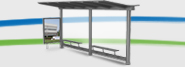
- All Enhanced Bus stops will have shelters
- Is more affordable than the BRT and will not require additional grant funding
- Uses existing bus stops and existing 40-foot buses
- Includes Transit Signal Priority, which keeps the traffic light green longer while the bus gets through the intersection, contributing to a faster trip for both Enhanced Bus and regular Route 1 service
- Will provide a new and vital connection to Tacoma Dome Station, including timed connections with Sounder trains
Early 2023 Updates
Thank you for your interest in Pierce Transit’s Bus Rapid Transit (BRT) project. The BRT project is at about 60 percent design. This is the South Sound’s first BRT line and has required extensive and in-depth planning, with new partners and processes. Recent work entailed partner coordination on requirements related to permitting and running service along a state highway and gathering more details on anticipated costs. Below is a summary of recent project activity and desired outcomes.
Overall Status
Anticipated costs for the BRT project have risen significantly. This is due to several factors, including inflation; COVID-related supply chain issues affecting the construction marketplace; and additional time and associated expenses needed for new processes, procedures and partnerships. New information was gleaned from the work completed to date, such as requiring more utility moves than anticipated, potential roundabouts, and air space leases due to center running ways. As the project team worked to lay out the BRT block by block as planned (including with new requirements, such as roundabouts), the number of impacted properties has risen significantly, not only affecting local property owners, but significantly increasing costs.
Even with hard-fought current funding of $60M from ST3, some state funds, federal grants, and local and agency funds, the cost of the project as originally planned is running well beyond the funding available. Also, as we have worked through the issues outlined above and the increased time to address them, the timeline to deliver the original BRT project has been continually moved out, currently to 2028.
Pierce Transit is Committed to:
- Delivering an express transit service to our community that is within a budget the agency can afford to not only start, but finish.
- Delivering this much-needed service to our community as soon as possible, rather than five or more years from now.
- Minimizing impacts to property owners and businesses along the corridor, who are already struggling to recover from COVID-related and inflationary pressures.
To Achieve These Goals:
- Pierce Transit is exploring ways to reduce the BRT project’s costs through value engineering work, which is a systematic and organized approach to providing the necessary functions of a project at the lowest cost.
- A value engineering workshop was held May 30 to June 1, with project partners working to establish a common understanding and agreement on the requirements for design elements and processes.
- The design team and Pierce Transit staff are further developing approaches to provide more accurate cost, schedule, and risk information for evaluation.
- The Pierce Transit Board of Commissioners will hold a study session in July to examine possible changes to the project that will help achieve the goals outlined above.
- The public is invited to comment at the July study session and can submit comments and questions anytime using the BRT website, email, and phone numbers listed below.
- Following Board review and staff evaluation, recommendations will be made for a direction to move the project forward in a manner Pierce Transit can afford and that delivers more quickly for our community.
Refresher on the Stream Community Line BRT Project
What is Bus Rapid Transit?
- BRT is an innovative, high-capacity, fast transportation option that combines the speed and feel of light rail with the flexibility, lower cost and simplicity of a bus system.
- Pierce Transit’s multi-line BRT system will be called “Stream,” and the first line, called the “Community Line,” will run from downtown Tacoma to Spanaway.
- BRT reduces traffic congestion and tailpipe emissions and provides access to fast, reliable transit for those with low incomes, those who do not own a car, cannot operate a vehicle and/or face other barriers to private transportation ownership.
Program: The Community Line is the first of multiple BRT Stream lines planned for Pierce County.
Project: 14.4-mile BRT line that will provide rapid and frequent transit service between downtown Tacoma and Spanaway.
Project Partners: Federal Transit Administration, WSDOT, City of Tacoma, Parkland, Spanaway, Pierce County, MultiCare, utility partners, Sound Transit (through funding from ST3).
Design: Currently at 60 percent design completion.
Features: Easier, faster, safer ways to get on and off the bus and to your destination, including features that give buses priority traveling through traffic signals.
To learn more and get involved:
- Email: BRT@piercetransit.org
- Receive updates: PierceTransit.org/StayConnected(enter email, click “Bus Rapid Transit Project” category)
- Phone number to call for general BRT questions: 253.983.3407
2021-22 Key Changes
Pierce Transit is committed to bringing fast, efficient, frequent transit service to our community. Here’s an update on our BRT 1 Stream service.
- Station refinements
- Adjustments at 56th Street (no roundabout)
- Roundabout at 96th
- Curbside stations between 64th and 84th
Revised Design and Timeframe
Due to challenges experienced during the COVID-19 pandemic and delays in design and permitting, the new service is expected to begin early 2027.
Pandemic-driven inflation prompted “value engineering” of the project, which means we are looking for ways to reduce costs while retaining the project’s benefits. One way we have done this is by creating three right-sized station designs (24, 18 and 13 feet wide), depending on projected ridership at station locations. For example, the station at 112th St. will see many riders getting on and off to access businesses and make transfers to other routes, so it will feature a 24-foot station canopy. The station in the quieter residential area at S. 64th St., connecting with the east-west cycle track, will have a modest 13-foot canopy.
The intersection at S. 56th St. will remain signalized (with traffic lights) and will likely not feature a traffic circle (roundabout), as previously explored. Project partners are working on that change now. A traffic circle is planned for S. 96th St. to improve travel times and reduce congestion. Pedestrian crossings and offset boarding locations are a priority at this roundabout to manage traffic flow and provide safe accessibility.
Some sections of the corridor that were previously identified for median, transit-only lanes will now be designated curbside in mixed-use traffic, much like Route 1 runs today.
By decreasing right-of-way impacts and construction costs, we reduce risk to the project schedule and budget. Provided things move forward as planned with permitting and available supplies, construction is expected to begin in the fall of 2024.
Partners Get on Board
Pierce Transit is pleased to announce that Pacific Lutheran University, with long-standing connections in Pierce County, has lent community support to the BRT project and will receive naming rights to two BRT stations at Pacific Ave & Garfield Street.
This partnership provides PLU identification at both stations, in audible bus stop announcements and on BRT maps. It brings new meaning to the school’s rallying cry, Go Lutes!
As announced last year, MultiCare is also partnering with Pierce Transit to support the BRT 1 Stream line. Riders will see MultiCare’s name on station signage near their facilities along the corridor, and throughout the system with MultiCare’s exclusive naming rights to this BRT line.
September 2021 Public Meeting Recap
To continue discussions about the BRT project, while meeting social distancing requirements, Pierce Transit hosted a live-streaming, public meeting on September 23, 2021. To all of you who participated, thank you for joining the conversation! In case you missed it, you may view a recording of the meeting below. Click here to download the open house presentation.
Get ready to Stream
The Pierce Transit Board of Commissioners selected Stream as the name for Pierce County’s Bus Rapid Transit (BRT) system. Since the name was chosen for an entire BRT system, it will apply to the line planned for Route 1, as well as future Pierce Transit BRT projects on Routes 2, 3, 4 and 402.
LEARN MORE HERE
Project overview
Pierce Transit is planning a Bus Rapid Transit (BRT) line along a 14.4-mile portion of Pacific Avenue/SR-7 between downtown Tacoma and Spanaway. The corridor is currently served by Pierce Transit’s Route 1, which has the agency’s highest ridership.
Property Owner Information
Click here for our interactive BRT Impacts map and to view all previously mailed documents.
Stream BRT in the news
- TV Tacoma’s Tacoma Report May 27, 2021 episode
Current Corridor Designs

December 2020 VIRTUAL PUBLIC MEETING RECAP
To continue discussions about the BRT project, while meeting social distancing requirements, Pierce Transit hosted a live-streaming, public meeting on December 10, 2020. To all of you who participated, thank you for joining the conversation! In case you missed it, you may view a recording of the meeting below.
Archived Documents
Project Overview
BRT Project Update November 2022
BRT Route Overview October 2022
BRT Project Update 9/2021 - Khmer Cambodian
BRT Project Update 9/2021 - Korean
BRT Project Update 9/2021 - Russian
BRT Project Update 9/2021 - Chinese
BRT Project Update 9/2021 - Spanish
BRT Project Update 9/2021 - Tagalog
BRT Project Update 9/2021 - Vietnamese
Public Meeting Summary - 2/10/2020
BRT Project Update - 3/2021 Spanish Version
BRT Project Update - 3/2021 Vietnamese Version
BRT Fact Sheet - 01/2021 (Vietnamese)
BRT Fact Sheet - 01/2021 (Spanish)
Community Committee Document - 08/24/2020
BRT Community Meeting - 03/06/20
BRT Community Meeting - 11/12/19
Useful Facts - 5/6/2019Spanish
Reports
Alternative Analysis Executive Summary - 11/2019
Alternative Analysis Report - 11/2019
BRT Environmental Issues - 08/24/2019
HCT Purpose and Need - 09/27/2018
First Last Mile Access Improvements - 9/27/2018
Environmental Critical Issues Report - 8/24/2018
Service Alternatives Evaluation - 10/12/2017
Existing and Future Conditions Report - 6/2/2017
Purpose & Need, Goals & Objectives, Evaluation Measures - 5/31/2017
Routing/Design
BRT Safety Improvements - 04/2021
168th St S to Spanaway Transit Center - 12/2020
S 38th St to S 96th St (Tacoma) - 12/2020
S 96th St to 168th St S (Pierce County and Parkland) - 12/2020
ArchiVed FAQ
-
How will the new BRT service affect local service on Route 1?
+The BRT service will replace Route 1 between Spanaway and downtown Tacoma. It will follow the same routing with the exception of stopping at the Tacoma Dome Station to provide connections to other transit service, and serving downtown using Market Street instead of Pacific Avenue. Running both Route 1 and BRT would require us to reduce BRT pickups to every 15 minutes, and reduce Route 1 pickups to every 30 minutes. Even with those reductions, running both services would cost an additional approximately $2 million per year.
-
What happens to Route 1 from Commerce Station to Tacoma Community College?
+The portion of Route 1 between downtown Tacoma and Tacoma Community College would continue to operate using the same schedule and routing as the current service. The Route 1 would connect with the BRT service at the Commerce Street Transit Center.
-
What will BRT mean for economic development along the corridor?
+Typically, Bus Rapid Transit systems generate increased economic development along their corridors, as people have better access to educational, vocational and job opportunities, and businesses in the area. The City of Tacoma and Pierce County have already identified this corridor for higher-density, mixed-use, transit-oriented development.
-
Will BRT increase or decrease congestion?
+Congestion mitigation is one of the project’s primary goals. Faster, more frequent, more reliable service will provide a competitive alternative to driving, thereby reducing the number of cars in the corridor.
-
Will BRT require the removal of general-purpose lanes along the corridor?
+Plans currently outlined in the feasibility study do not call for the removal of any general-purpose lanes along the corridor. In some instances, a dedicated transit lane for buses and vehicles turning right may be added, or the bus may travel in the median lane, but the scenarios under consideration do not eliminate general-purpose traffic lanes. The 14.4-mile corridor has widely-varying travel configurations, so the portion of roadway where the bus runs will likely vary throughout the corridor. On-street or surface parking could change, depending on path of travel and station locations.
-
Is BRT a tested transit option?
+Yes, BRT is a rapidly-growing transit mode in Washington state. In the Puget Sound area, King County Metro has RapidRide and Community Transit has Swift. In Vancouver, C-TRAN recently opened The Vine, and Spokane Transit is in the planning stages for their inaugural BRT line.
-
How much do BRT projects typically cost?
+BRT projects typically cost about $10 million per mile. The Pacific Avenue | SR-7 BRT project is estimated to cost about $150 million (including vehicles). By contrast, street cars cost about $30 million per mile and light rail costs $200 million per mile.
-
How much faster will that 14.4-mile trip be once BRT is implemented?
+The answer to this question will depend on how much of the route will have dedicated transit lanes and how much time the bus will spend in mixed traffic. The more dedicated lanes, the faster the route will run. We will have a better sense of how much faster the trip will be once the lane configurations are selected in each segment of the corridor. Typically, BRT systems operate from 15-30 percent faster than the local fixed route. Since our current fixed route (Route 1) requires as much as 55 minutes to ride from Spanaway to downtown Tacoma, the agency will do whatever is possible to design a new BRT route that reduces that travel time by the maximum amount possible.
-
Will construction of the BRT line require the purchase of any private property?
+We estimate the BRT project will require the cumulative purchase of just over one acre of private property in total along the 14.4-mile corridor.
We estimate this will impact small portions of about 150 properties along the route. There are approximately 100 additional properties that may require temporary construction easements. These easements are only needed for construction purposes and will not impact properties long term.
Where we will need to purchase these small portions of private property, Pierce Transit is absolutely committed to minimizing impacts to property owners by working with them and considering realistic alternatives that are agreeable to both parties.
The BRT project will not require the purchase of any entire parcel, nor will it shut down businesses or require the acquisition of homes.
If you have questions about potential impacts to your property at this phase, please email us at brt@piercetransit.org with your address and contact information, and we will contact you.
The BRT project is currently at only 30 percent design. Once we enter the full design phase and begin mapping out specifics along the corridor, we will contact property owners who could potentially be impacted by the project and begin working with them.
-
I’ve heard the BRT will result in the closure of small businesses and displacement of homes. Is that true?
+No. The project will not require the purchase of entire parcels, businesses, or homes.
Pierce Transit is committed to assisting small businesses by locating BRT stations in business districts along the corridor that would most effectively deliver existing or potential customers to those locations.
If you have questions about potential impacts to your property at this phase, please email us at brt@piercetransit.org with your address and contact information, and we will contact you.
-
How will the BRT line impact parking along the corridor?
+As with any thoroughfare, there is public right-of-way along the outside edges of the Pacific Avenue/SR 7 roadway. Some of this public right-of-way is currently being used for parking but may be needed for completion of the BRT project.
-
Will it require the removal of parking on private property?
+Since the project is currently only at 30 percent design, the actual number of on- or off-street parking spaces that could be removed to accommodate the BRT is not yet finalized. However, once those exact locations are determined in the Preliminary Engineering/Design phase later in 2020, we will contact and begin working with potentially-affected property owners.
-
Will the BRT line remove some options for left turns?
+Under the Median-Hybrid Alternative approved by Pierce Transit’s Board of Commissioners, the BRT line will travel in mixed traffic for 8.8 miles, in curbside lanes intended for the use of buses and cars turning right (known as Business Access and Transit or “BAT” lanes) for 1.6 miles, and in a bus-only lane or lanes in the median for 4.0 miles.
Where the bus runs in the median, cars turning left will be required to go to the next traffic signal to make a U-turn and come back along the block to access a home driveway or business parking lot.
Referring to the Median-Hybrid concept drawings (available online), left turns could be restricted at the following streets (listed from north to south):
- • S. 40th Street (U-turns at 43rd to the south or 38th to the north)
- • S. 55th Street (U-turns at 56th to the south or 50th to the north)
- • S. 57th, 58th, and 59th Streets (U-turns at 60th to the south or 56th to the north)
- • S. 61st, 62nd, and 63rd Streets (U-turns at 64th to the south or 60th to the north)
- • S. 65th, 67th, 68th, and 70th Streets (U-turns at 72nd to the south or 64th to the north)
- • S. 78th Street (U-turns at 84th to the south or 76th to the north)
- • 107th Street S (U-turns at 108th to the south or 96th to the north)
- • 114th Street S, Violet Meadow Street E, 115th, 116th, 117th, 118th, 119th, and 120th Streets S (U-turns at 121st to the south or 112th to the north)
- • 122nd and 123rd Streets S (U-turns at Tule Lake to the south or Garfield Street to the north)
However, as part of the final design phase, options to allow for more left turn opportunities can be explored. One such option would be to add designated U-turn areas at ¼-mile or shorter mid-block intervals for automobiles and passenger trucks only, between the intersections listed above.
This road treatment is becoming more typical throughout the county and our region. For example, this lane treatment is used along Bridgeport Way W. in University Place, which has planted (landscaped) medians throughout its entire central business district, meaning left turns or U-turns are only allowed at intersections. In Seattle, much of the Aurora Avenue N/SR 99 RapidRide BRT corridor has a continuous Jersey barrier, wall, raised median, or other limited access barrier between intersections.
-
Will there be any other lane treatment impacts?
+The Washington State Department of Transportation requires that roundabouts be considered any time an intersection is changed. We are working with WSDOT and the City of Tacoma now to determine how many roundabouts might be required along the corridor. We are currently showing roundabouts at 121st, 138th, and 146th as these intersections show benefits to both transit and general purpose traffic.
-
Stations will be farther apart than the bus stops are now. Why, and how does that impact riders?
+BRT systems have fewer stops than a typical bus line. This, along with features at the stations that help people board and disembark faster, is what makes the line “rapid” and moves the bus more quickly up and down the corridor.
Pierce Transit’s BRT line between downtown Tacoma and Spanaway will have approximately 32 pairs of stations, down from 65 pairs of stops now located along that portion of the Route 1.
We have carefully analyzed the stops located along the route with the goal of eliminating those with the lowest daily ridership and retaining stops in areas with the highest ridership. We are also prioritizing stops at locations that offer east-west connections and reach key destinations in the corridor.
Once the current 32 BRT station pairs are constructed, the average spacing between them will be approximately 0.45-mile or just under a half-mile. This means someone walking north or south along the corridor will never be more than a ¼-mile from the nearest BRT station; about a five-minute walk.
While the longer distance to catch the bus may impact those with less mobility, it is important to note that Pierce Transit does provide door-to-door paratransit SHUTTLE service for those who cannot ride the regular bus due to a disabling condition.
When BRT systems are implemented, they typically include pedestrian infrastructure and accessibility upgrades along the corridor that make it easier and safer to access the stations and get on transit.
-
Will the BRT increase traffic in adjacent neighborhoods?
+Potentially, especially during the construction phase. In the bigger picture, however, the goal of the project is to reduce traffic volumes throughout the Pacific Avenue/SR 7 corridor by shifting more Single Occupancy Vehicle trips to transit trips – especially once BRT is proven to offer a faster, more reliable, and travel time-competitive option than driving. In addition, both the City of Tacoma and Pierce County have agreed that residential parking permits could be issued within ¼-mile of the corridor, in order to avoid “Hide-and-Ride” on-street parking by system patrons in adjacent neighborhoods.